Digging Deeper into Climate Change Data

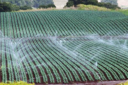
(Photo by Lance Cheung, USDA)
As the world’s leading agricultural export market in the nation, California has a lot at stake in the climate crisis. According to the California Department of Food and Agriculture, California’s agricultural production is valued at $50 billion with exports totaling $20.8 billion in 2020. The ever-changing weather patterns that climate change is causing could lead to significant farming challenges. Fortunately, California farmers now have a web-based tool to help them navigate through difficult conditions due to climate change.
“There are other types of these tools around the United States that are kind of region-specific for the commodities and those regions, but we didn't have one in California,” said Steven Ostoja, director for the USDA California Climate Hub. “Essentially CalAgroClimate is a free online compendium, if you will, of tools and resources to help growers or crop consultants make better decisions about what they might need to do or want to do to address the concerns of climate change.”
CalAgroClimate is a web-based and mobile-friendly decision support system that translates high-resolution gridded weather data and forecast information into decision support tools designed to provide both location and crop-specific information for managing risks. It was developed by the USDA California Climate Hub and the University of California Cooperative Extension.
CalAgroClimate currently has four tools available for users: heat advisory, frost advisory, crop phenology and pest advisory. The heat and frost advisory tools work in similar ways: users are given a map where they can select certain locations and temperature thresholds based on specific crops. Temperature thresholds for heat range from 90 F to 100 F while frost thresholds range from 35 F to 28 F. Farmers are also able to determine heat and frost risk for the next 7 days for a given location, including the number of consecutive days with temperatures above or below thresholds for selected crops.
The crop phenology tool is used for crop-specific and location-specific purposes, where the user can monitor growing degree accumulations and estimates when the crops reach certain growing stages. It can even advise users about past crop developments and compares growing seasons from previous years. The pest advisory tool helps users track projections based on past generations of pests and diseases using temperature and heat unit accumulations.
Ostoja said he believes CalAgroClimate can provide stakeholders with science-based data to help reduce the risk associated with climate change.
“Ultimately, our hope is that there is a reduction in indemnity and crop insurance claims. CalAgroClimate provides users a means to evaluate risks and make decisions to protect against economic and bottom-line losses due to weather and climate events,” he said. “What we're really hoping to do is just let people have that comfort, knowing that they're able to make decisions that are based on the best available science that's readily available and that's accurate, so that they feel more comfortable and confident.”
Ostoja and his team continue to search for ways to make CalAgroClimate even more useful for its users. They are collecting more user feedback, improving the user interface, and holding workshops for potential users. Ostoja said that they also hope to add a user feedback tool to the website soon to allow users to share their feedback, impressions and suggestions.
“This spring we also plan to take CalAgroClimate to do focused workshops with specific groups to both facilitate and better understand this tool,” he said.
USDA Climate Hubs were created in 2014 to develop and deliver science-based, region-specific information and technologies to agricultural and natural resource managers that enable climate-informed decision-making, and to provide access to assistance to implement those decisions. By Andrew Casas, ARS’s Office of Communications.
You May Also Like:

